Harris County faces the worst of Tropical Storm Edouard's rainfall, Gov. Greg Abbott said Aug. 31. Some areas could see 10 to 15 inches of rain at rates of 3 to 4 inches per hour.
Abbott made the announcement during a press conference in Austin, calling Harris County the zone of most intense rainfall. He said winds could reach 60 mph at landfall. The state has activated more than 1,500 personnel across 20 agencies, along with rescue aircraft, swift water rescue boats and high-water vehicles, according to Houston Public Media. The state's emergency operations center was activated to run around the clock, Abbott said.
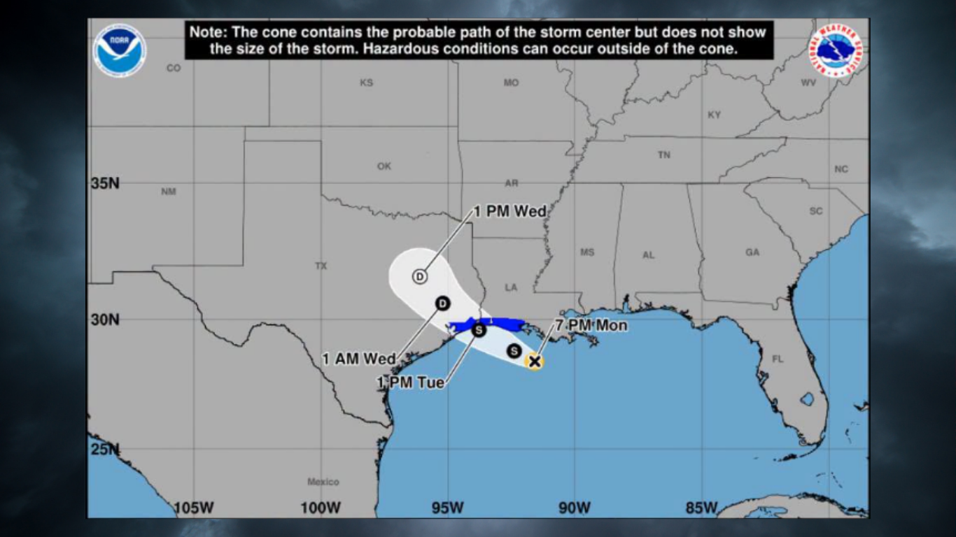
As of 10 a.m. Tuesday, Sept. 1, Edouard had maximum sustained winds of 50 mph and was about 30 miles south of Cameron, Louisiana, moving northwest at 8 mph, according to KXAN's storm tracker. A Tropical Storm Warning is in effect from Port Bolivar to the Vermilion-Iberia parish line in Louisiana. Landfall is expected Tuesday afternoon near Chambers and Jefferson counties, east of the Houston metro area.
NWS forecasts 3 to 6 inches for Spring area
The National Weather Service projects 3 to 6 inches of rain along and east of Interstate 45, with the highest chances starting late morning and extending through Tuesday evening, according to the Texas Tribune. Some spots could receive 6 to 9 inches, NWS forecasters said.
NWS warning coordination meteorologist Jimmy Fowler said flash flooding will be possible "especially over areas of poor drainage" where heavier totals occur. NWS meteorologist Brian Kyle said the metro area and points northward face primarily a rainfall threat, according to Houston Public Media.
Harris and Galveston counties are under a flood watch from 1 a.m. Tuesday through 7 a.m. Wednesday, according to the National Weather Service. A storm surge of 2 to 4 feet is possible along the coast.
Abbott warns against driving into floodwaters
Abbott said heavy rainfall would begin Monday night, with the most intense downpours expected after dark Tuesday. He called the nighttime timing especially dangerous.
"We have seen too often vehicles being swept away. It is so incredibly important for anybody in any region of the state, but especially in Harris County, to avoid driving into what appears to be waters on the roadway," Abbott said at the Monday press conference.
Local and state agencies prepare
Harris County Judge Lina Hidalgo encouraged residents to use caution driving Tuesday, according to Houston Public Media. Houston's Emergency Operations Center planned to open at 9 a.m. Tuesday at a "high readiness" level. The Houston Police Department and Houston Fire Department were staging trucks and boats around the city.
Thomas Gleeson, chair of the Public Utility Commission of Texas, said CenterPoint and Entergy have activated emergency operation centers. Crews have been clearing vegetation to reduce outage risk from high winds and are on standby to restore power.
Pablo Vegas, CEO of the Electric Reliability Council of Texas (ERCOT), said there are no restrictions on energy usage on the grid. Transmission lines are built to withstand winds exceeding 110 mph, Vegas said, well above what Edouard is expected to produce.
School closures and safety steps
Humble ISD, which serves parts of the Spring area, canceled Tuesday classes, according to the Houston Chronicle. Klein ISD and Spring ISD were not listed among closures in available reporting.
The Harris County Office of Homeland Security and Emergency Management urged residents to stay weather-aware and sign up for alerts by texting GULF2026 to 888777.
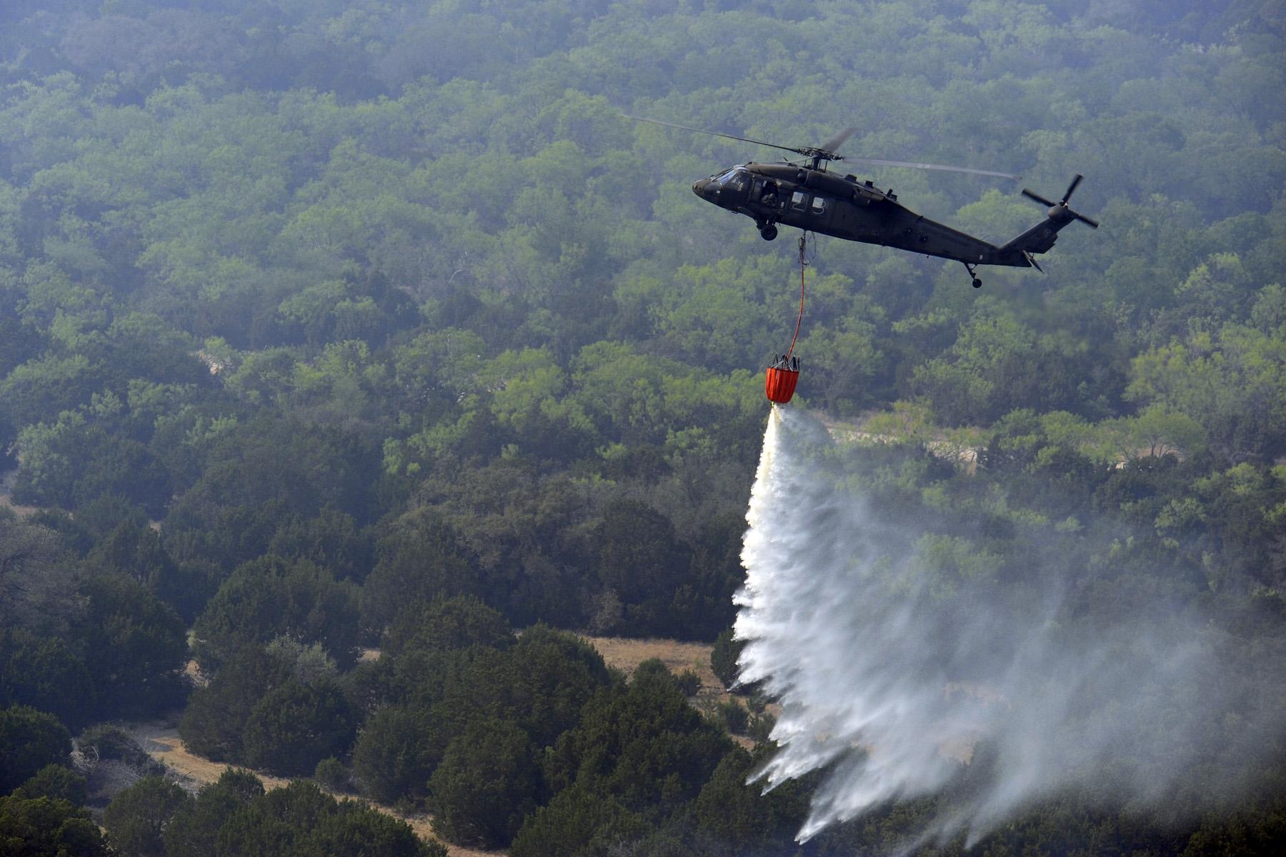
Abbott also warned of wildfire risk from high winds hitting dry ground. "Just because it may be raining, the ground is dry, the grass is brown," he said. "The conditions exist where a fire can spread very rapidly, and be safe about that."
The flood watch runs through 7 a.m. Wednesday.